As with all of the other days that I've been in Abu Dhabi, yesterday was yet another adventure. I was on the mangrove team but we visited the other team that was collecting soil cores in the coastal sabkha and algal flats before getting to work. Sabkha basically refers to a salt flat. Sometimes it gets inundated and you get extensive algal mats. I've yet to be on one of these crews so I don't have photos yet, but apparently they're unlike anything you've ever seen before and are a trip to walk on. Depending on how dry the sabkha is, you get thick layers of salt on the soil surface that break apart into polygons about 1-2 ft in diameter. I haven't seen these yet either but I got to see some of the salt sheets that the crew collected. I did get to see a sabkha that is inundated occasionally and all of the soil cores are showing a rich history of activity that kind of is escaping explanation. No one seems to know if the land is rising here (tectonics) or if sea level is going down, but definitely something is happening to produce these weird soil characteristics over time.

Sabkha up close

Pat Megonigal, my new boss at the Smithsonian, and his soil core

This was interesting, but what surrounded the area that they were sampling is almost beyond explanation. The Sheik (president of UAE and rule of Abu Dhabi) likes mangroves and had decided to modify sabkha so that extensive mangrove plantations can be created. From our estimates, 75 square kilometers (15 by 5km) have been excavated to allow for this, and this is just in one area. I can't even begin to describe how insane this process is, but perhaps an aerial imagery of this might help.
BEFORE

!!!!!!AFTER!!!!!!

Basically they're digging huge linear channels and grading the sabkha down so that it's in the intertidal zone. This requires constant excavation, removal by trucks, and dumping the dirt somewhere. From what we could see, when an excavator broke down, they just leave it there with the bucket in the ground, take parts, and buy a new one. The excess and waste is almost indescribable and there were no environmental impact reports. By no means is this a restoration project, nor is it for carbon offsetting (I can't even begin to imagine the carbon footprint of this project - these mangrove will likely never compensate for that). If all goes according to plan and the 15 million (!!!!) mangroves are survive, this will be the biggest single mangrove plantation ever created. But from what I can tell, the islands are being graded to elevations that are at the low end of what mangroves can tolerate, and many of the saplings plants appear to have died.


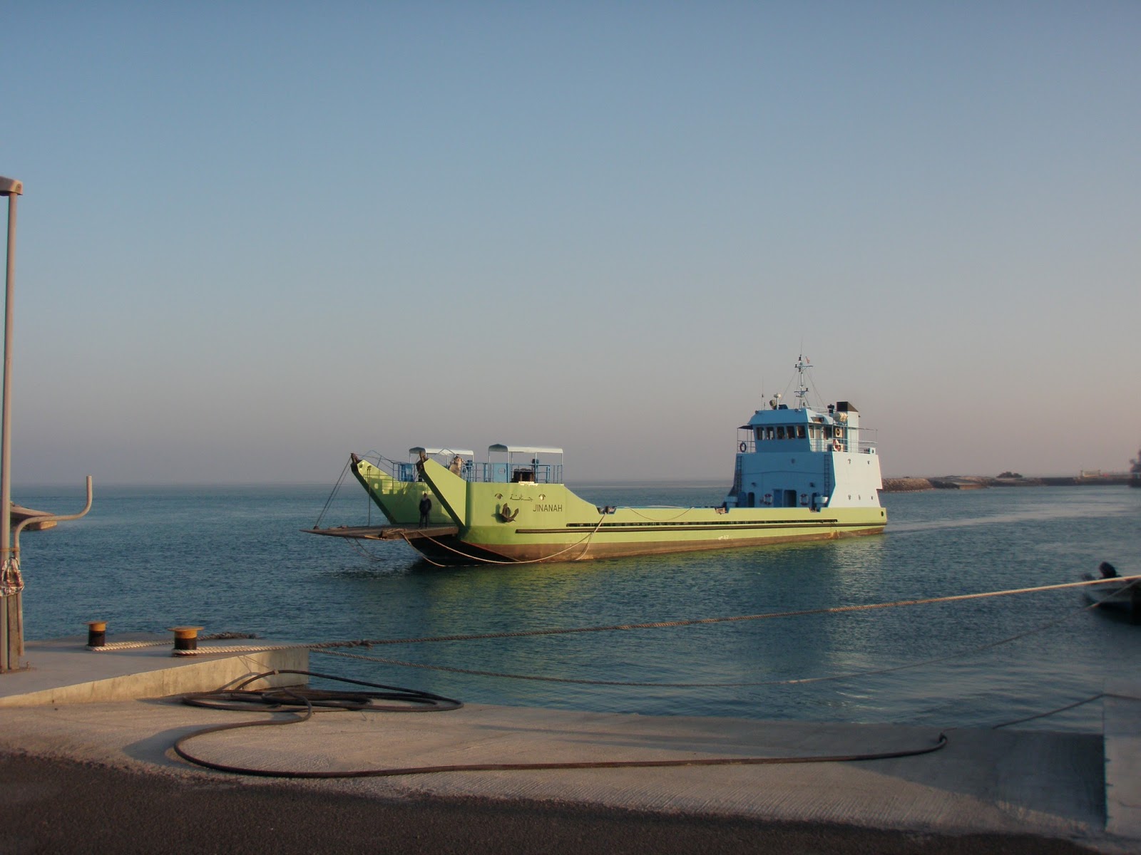
Ok, enough on that (although I could go on for paragraphs about all of this). We went back to the President's island again to finish sampling the mangroves. This required a short ferry ride across the gulf.
We sampled in a 17-20 year old mangrove site and it had a lot of seedlings, which was nice to see.


I was working with two awesome women who study mangroves in Indonesia, Afi, and Madagascar, Lalao.

Another colleague, Edwin, found a sea slug.


We raced to beat the fog that was coming in, but I managed to take some photos of neat bird and animal (feral cat or fox) prints in the sand.


The fog came in super fast, and we got a bit lost on the island. It was really surreal, to say the least - who gets to drive haphazardly on the president's island?!?!? We saw endless construction and the flamingo feeding area, and eventually made our way back to the ferry.


I'm now about to load up in a car to go to the desert farm of Hadhir, one of our amazing logistics guys. I can't wait!!!
That would an awesome experience there. Playing in the desert sands.
ReplyDeleteSaadiyat Island